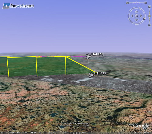
My brother flew out to Manila yesterday for Christmas, so I was tracking his flight using FBOWeb.com’s über-cool flight tracking in Google Earth — that’s FAA flight metadata mapped in 3D onto Google Earth and updated live! It was pretty cool to watch the progress of the flight as it headed along the transpolar route to Asia (though I still wonder why the route was so zigzaggy) when suddenly I saw this and panicked:
Turns out the flight data was simply returning a TIMEOUT because the plane had gone beyond the airspace within which FAA tracking could occur. So no, my brother’s plane did not come crashing down somewhere in the tundra. (I just talked to him on the phone, in fact — he’s in Manila right now.)
Update: Over on Flickr, wrastle123 explains the zigzagging path:
“Just a heads-up, the zig-zagging is a result of multiple data sources providing the original flight positional data. One source is more accurate than the other; that, and the positions come in at slightly different/offset times, giving the overall track a zig-zagging effect.”
